

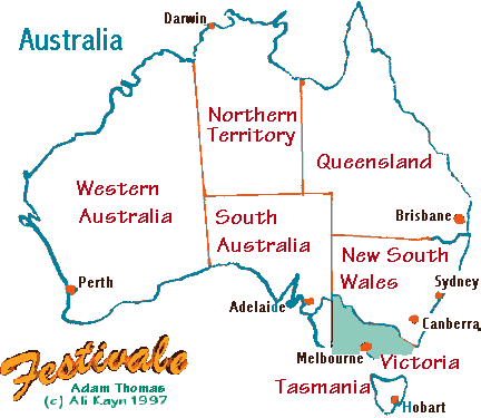
Where are we?
Guidebook's Australian Maps
Map of Australia
(Southern Hemisphere)
To see where Australia is on Earth, zoom out. To find out more about a state, click on that state.
As school children we are taught that Australia is the "world's largest island and smallest continent".
This is incorrect, as the definition of island is a body of land completely surrounded by water that is smaller than a continent [Readers' Digest Guide to the Places of the World]).
It is 7,682,300 square kilometres, about the same size as the mainland states of the USA, making it the world's sixth largest country. It covers approximately 5% of the Earth's land surface.
Australian coat of arms
Australia lies between the Pacific and Indian Oceans, and measures approximately 4,000 kilometres from east to west, and 3,200 kilometres from north to south. The coastline is some 36,735 kilometres long.
The Australian continent is one of the most stable land masses on Earth, with only a little seismic activity in the eastern and western highland areas.
Only the Snowy Mountains area (around the New South Wales/Victorian border) and in Tasmania, have regular snowfalls during winter.
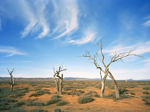
Australian desert scene; photograph courtesy australia.com
Just the Facts
Capital: Canberra
National floral emblem: golden wattle (proclaimed 1988)
National animal: kangaroo
National gemstone: opal (proclaimed 1993)
Longest river system: Darling River 2,736km (1,700 miles); Murray River 2,575 kilometres (1,600 miles); Murray-Darling system 4684km (2,911 miles). River lengths are difficult to measure and reported lengths vary.
Largest lake: Lake Eyre 9,500 sq km
Highest peak: Mount Kosciuszko, 2,228 metres (7,310 feet) above sea level, spelling changed in 1997 from Mount Kosciusko
Lowest point: Lake Eyre, South Australia 15 metres below sea level
Inhabitants known as "Australians" or "Aussies". Abbreviations for Australia include "Aust." although Oz is also popular.
There is no national dress, the most recognisable Australian apparel includes the Akubra (slouch) hat and the Drizabone coat.
The national colours of Australia are green and gold (proclaimed 1984), the Australian national anthem is a revised version of Advance Australia Fair. Waltzing Matilda (Once a Jolly Swagman) is also recognisably Australian.
Australia was federated in 1901 - the beginning of the 20th Century. The first Parliament of Australia was held on 9 May 1901 at the Royal Exhibition Building in Melbourne, Victoria's Carlton Gardens. From 1901 to 1927 the Parliament met in the Victorian Parliament House.
In 1907, it was decided to locate the country's capital in southern New South Wales. The area became the Australian Capital Territory (ACT). The original Parliament House (now called Old Parliament House) was completed and opened in 1927. The current Parliament House was opened in 1988.
As the centennial of federation approached, with the new millennium in 2001, the republican movement gained media attention. Australians voted against the form of republicanism that was offered.
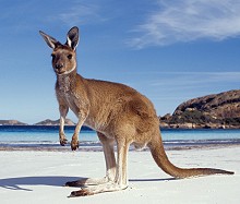
Australian kangaroo, courtesty australia.com
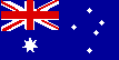
The Australian national flag, which has a strong British reference, has been the subject of several replacement competitions, but remains unchanged. Two other major flags that you will see are the Austalian Aboriginal Flag and the Torres Strait Islander flag.
At the turn of the twentieth century Australia was a leader in the new field of film-making. The first ever narrative feature film was The Story of the Kelly Gang in 1906. It was directed by Charles Tait and shot in and around Melbourne, Victoria. The film was entered into the UNESCO Memory of the World Register as the world's first full-length narrative feature film in 2007.
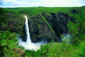
Wallaman Falls, Queensland; photographer: Peter Lik
Australia has an active film industry, and Melbourne, Victoria (Docklands Studios), Sydney, New South Wales (Fox Studios), the Gold Coast of Queensland (Village Roadshow Studios) and Adelaide, South Australia (Adelaide Studios) have large studios.
The wide variety of environments available in Australia make it an attractive place for location shoots.
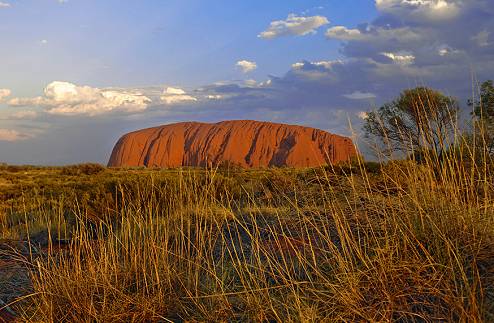
Uluru; photograph courtesy australia.com


Australian desert scene; photograph courtesty australia.com
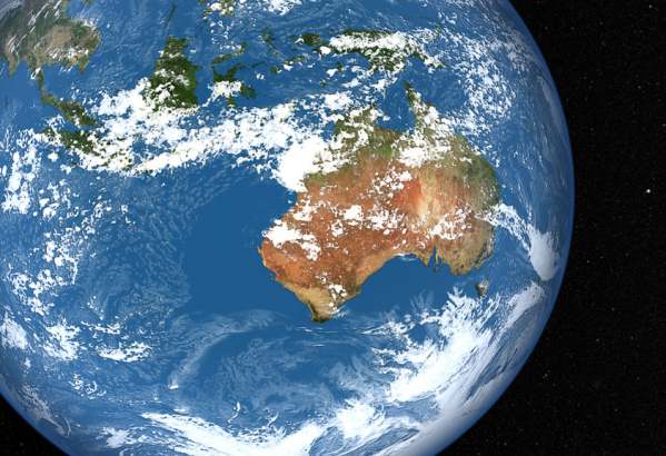
The clouds are derived from the Goddard Earth Observing System Model, Version 5 (GEOS-5). GEOS-5 is a system of models integrated using the Earth System Modeling Framework and used to help refine atmospheric weather models. NASA/Goddard Space Flight Center Scientific Visualization Studio
NASA Goddard Space Flight Centerenables NASA's mission through four scientific endeavors: Earth Science, Heliophysics, Solar System Exploration, and Astrophysics. Goddard plays a leading role in NASA's accomplishments by contributing compelling scientific knowledge to advance the Agency's mission.Follow us onTwitterLike us onFacebookFind us onInstagram
For posts about Melbourne events, places, news, reviews, giveaways, see our Facebook Page:


 Published in Melbourne, Victoria, Australia